
Drone Survey
LiDAR drone survey — the ground beneath the trees
Classified point cloud, bare-earth terrain, surface model and contours from the air — including terrain under vegetation that photogrammetry simply cannot reach.
Also called aerial LiDAR or laser scanning survey. Our drone operators are DGCA certified.
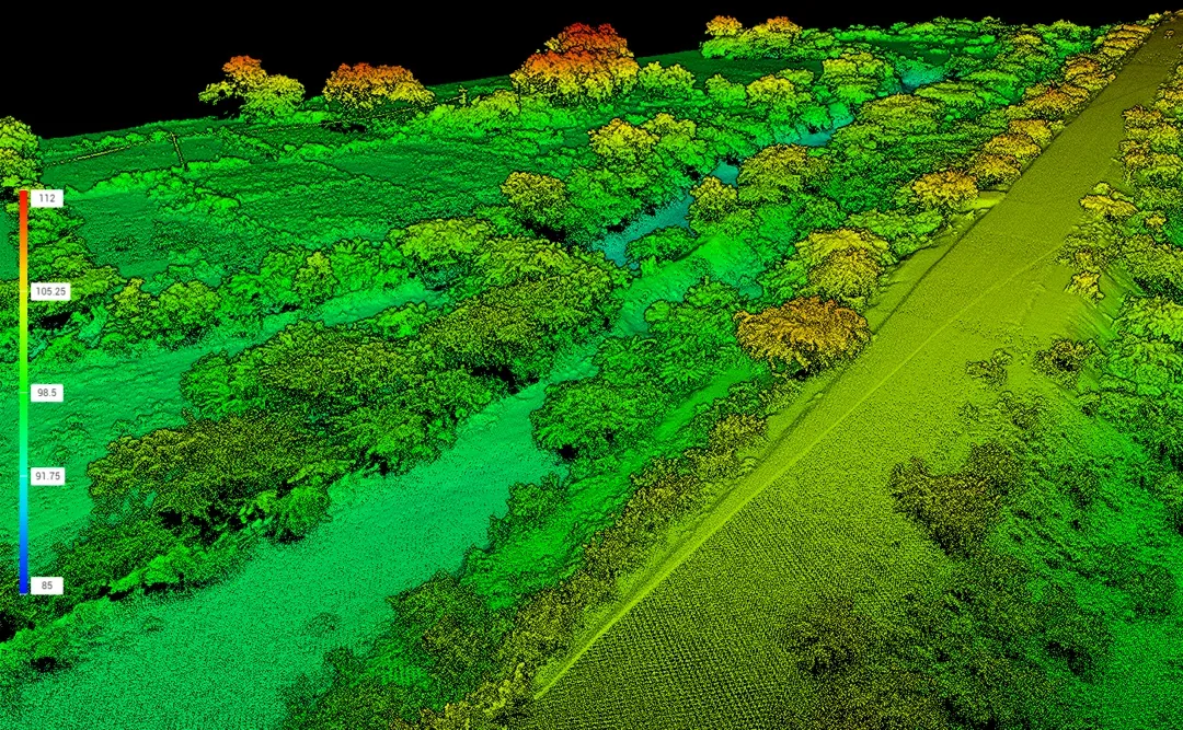
What you get
Agreed in the quotation before we fly. A LiDAR survey normally delivers:
- Classified point cloud — ground, vegetation, structures separated
- Bare-earth DTM — terrain with vegetation removed, the point of the exercise
- DSM — surface model including canopy and structures
- Contours at the interval your design requires, generated from the bare earth
- Cross sections and profiles where the project needs them
- Block levels and mesh derived from the same data
- Orthomosaic and 360 imagery where imagery is flown alongside
- Ground control record, check point results, and a note of where ground returns were sparse
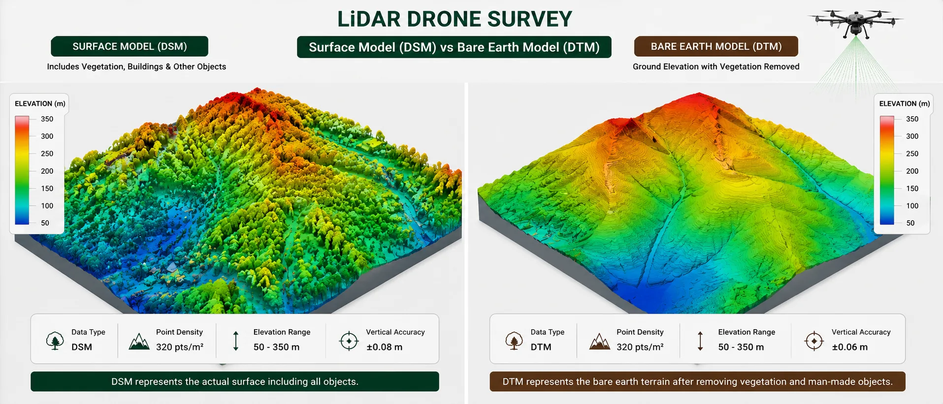
LiDAR does not see through leaves. It finds the gaps between them.
Photogrammetry has to match the same point across overlapping photographs. Under a closed canopy there is no ground visible in any of them, so the model reconstructs the top of the vegetation and calls it terrain.
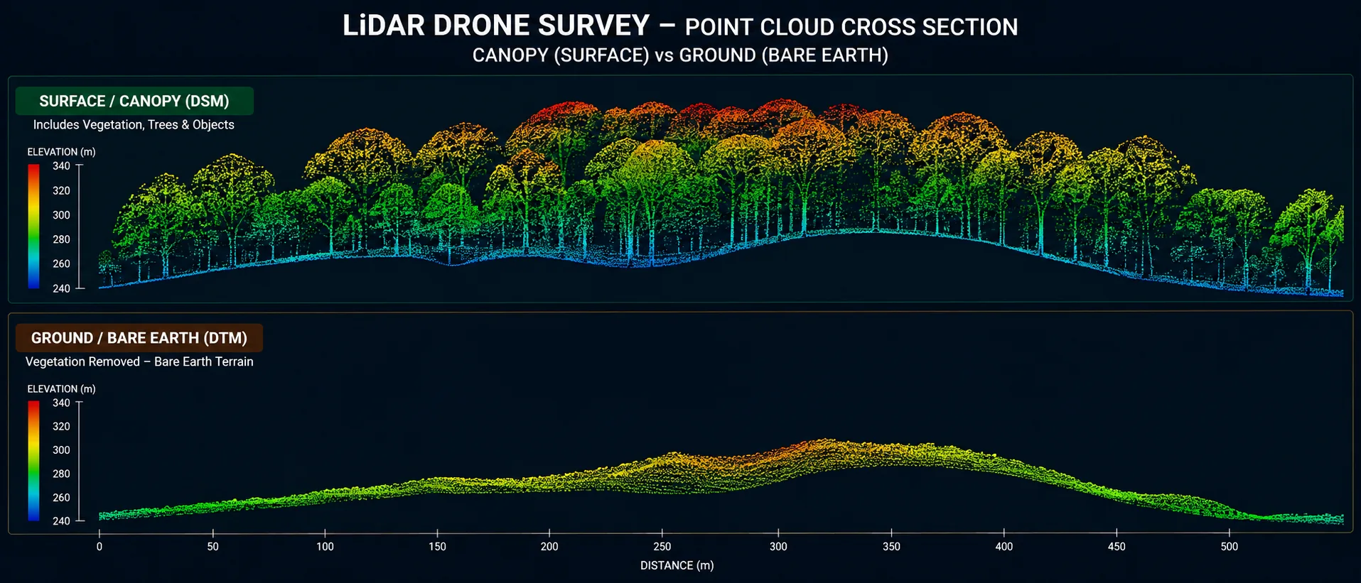
LiDAR sends out a very large number of laser pulses. Wherever a pulse passes through a gap in the foliage it reaches the ground and returns from there. It does not need a clear view — it needs enough gaps, and on most vegetation there are enough.
Those ground returns are then separated from the vegetation returns, and what remains is the bare earth beneath the trees.
When LiDAR is worth the extra cost
It costs more than RGB mapping, so it should be chosen for a reason rather than by default.
Worth it when:
- Wooded, plantation or scrub-covered ground where terrain is what you need
- Corridors running through vegetation — road, canal, transmission line, pipeline routes
- Heavily grassed embankments and cuttings, where grass alone lifts a photogrammetric surface
- Catchment and drainage studies over mixed cover
- Where earthwork volumes must be computed under vegetation
Not worth it when:
- The ground is open and bare — RGB gives comparable terrain for less
- The site is small enough to walk with a total station or DGPS
- Setting-out accuracy is what you actually need
Tell us what the ground cover is like and what the data is for. We will say honestly which method your project needs — including when the cheaper one is sufficient.
Classification is where the quality lives
The raw point cloud contains everything the laser returned from — ground, canopy, undergrowth, buildings, wires, vehicles, the lot.
Classification separates those into categories so the ground points can be used on their own to build the bare-earth model. How well that is done is what decides whether the DTM under vegetation is any good.
Automatic classification handles most of it and gets confused in predictable places — dense undergrowth read as ground, steep banks smoothed away, low walls absorbed into terrain. So it is reviewed rather than accepted as it comes out.
Where the ground returns run thin
The honest limit on this page.
Where enough pulses reach the ground, the bare-earth model is genuinely good. Where a canopy is close to impenetrable, ground point density drops, and the terrain between the surviving points is interpolated rather than measured.
We report where that happened. A smooth surface across an area with almost no ground returns implies a confidence the data does not support, and someone will later compute a volume from it.
Accuracy you can expect
| Measurement | Accuracy | Notes |
|---|---|---|
| Bare ground, open | ±30–50 mm vertical | With ground control, verified on check points |
| Ground under moderate vegetation | Degrades with cover density | Reported per area rather than as one figure |
| Ground control points, DGPS static | ±2.5 mm + 0.5 ppm | The framework the survey is anchored to |
| Under near-impenetrable canopy | Interpolated, not measured | Flagged on the deliverable |
Figures are typical achievable tolerances under reasonable conditions, not a contractual guarantee. Vegetation density is the dominant variable on a LiDAR job — which is why we report achieved accuracy against check points and note the areas where ground returns were sparse, rather than quoting one number for the whole site.
Typical applications
- Wooded and plantation landTerrain beneath cover, for development or valuation
- Vegetated corridorsRoad, canal, pipeline and transmission routes through scrub and trees
- Transmission line profilesGround and obstruction heights beneath the span, under cover
- Quarries and miningFaces and benches where vegetation has re-established
- Catchment and drainage studiesTerrain across mixed cover for flow modelling
- Earthwork under vegetationVolumes computed on bare earth rather than canopy
Related reading
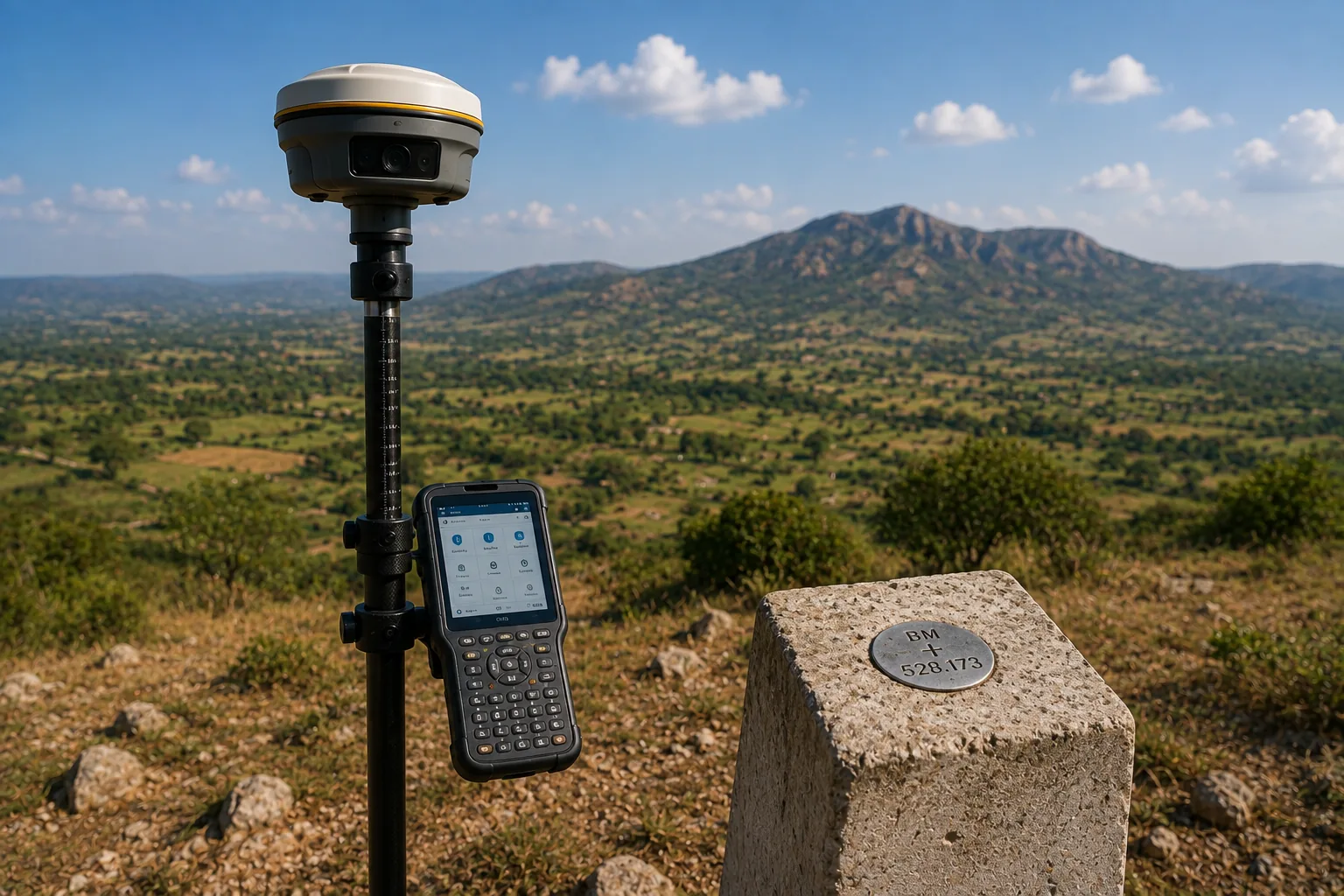
Like all aerial work, LiDAR rests on the ground survey beneath it — the control that anchors it and the check points that verify it.
- GPS vs DGPS — how control points are established
- Why satellite levels are not sea levels
- Total station or DGPS — how we choose the method
Related services
- RGB Drone Survey — the cheaper option on open ground
- DGPS Survey — the ground control behind every flight
- Contour Survey — contours from ground measurement
- Transmission Line Survey — profile beneath the span
- Highway Survey — corridor mapping
- Topographic Survey — the ground alternative
- All drone survey services
How we work
How we run a LiDAR survey
-
Assess the ground cover
What is growing on the site decides whether LiDAR is justified at all, and how the flight has to be planned to get enough ground returns.
-
Confirm permissions
Flight permissions applicable to the airspace over your site confirmed before scheduling, and any clearance requirement raised at enquiry stage.
-
Establish ground control
Control set by DGPS to survey accuracy, with independent check points withheld from processing so the result can be tested honestly.
-
Fly for ground returns
Coverage planned so enough pulses reach the ground through the canopy, flown by DGCA certified operators.
-
Classify and review
Ground separated from vegetation and structures, then reviewed rather than accepted as processed — because classification is where DTM quality is won or lost.
-
Derive, verify and issue
Terrain, surface, contours and sections produced, checked against the withheld points, and issued with sparse-return areas flagged.
Questions
LiDAR survey FAQs
It does not see through leaves — it finds the gaps between them. LiDAR sends out a very large number of laser pulses, and where a pulse passes through a gap in the canopy it reaches the ground and returns from there. Photogrammetry has to match what a camera can see across overlapping images, so a closed canopy simply blocks it. LiDAR only needs enough gaps, and on most vegetation there are enough.
When vegetation stands between you and the terrain you need. Wooded ground, plantation, scrub, overgrown corridors and heavily grassed embankments are all cases where photogrammetry maps the top of the vegetation and LiDAR maps the ground. On bare, open ground the two produce comparable terrain, and RGB is the sensible choice. Tell us what the ground cover is like and we will say honestly which one your project needs.
The raw point cloud contains everything the laser returned from — ground, vegetation, buildings, wires, vehicles. Classification separates those into categories so the ground points can be used on their own to build a bare-earth terrain model. The quality of that classification is what determines how good the DTM is under vegetation, and it is reviewed rather than left entirely to automatic processing.
Yes. Ground control anchors the survey to real coordinates and a real datum, and independent check points are what verify the finished result. The principle is exactly the same as for photogrammetry, and skipping it produces data that looks precise and sits in the wrong place.
Usually, but not always, and the honest answer is that it depends on the density of the cover. Where enough pulses reach the ground the bare-earth model is good; where a canopy is genuinely impenetrable the ground point density drops and the terrain between those points is interpolated. We report where ground returns were sparse rather than presenting a smooth surface that implies confidence we do not have.
Classified point cloud, bare-earth DTM, surface model, contours at your required interval, and cross sections or profiles where the project needs them. Block levels and mesh can be produced from the same data. Where imagery is flown alongside, an orthomosaic and 360 imagery can be delivered with it, so you get both the visual record and the terrain beneath the vegetation.