
Methods
GPS vs DGPS — why your phone is metres out and a survey receiver is millimetres
Both listen to the same satellites. The difference is that one of them also listens to a receiver standing on a point whose position is already known.
Why a single receiver cannot do better
A satellite navigation receiver works out where it is by timing signals from several satellites at once. If it knows how long a signal took to arrive, and it knows how fast the signal travels, it knows how far away that satellite is. Enough of those distances and the position falls out.
The weakness is in that middle assumption. The signal does not travel at a constant, known speed the whole way down. It slows and bends as it passes through the ionosphere and then the lower atmosphere, by an amount that changes with time of day, weather and how low in the sky the satellite sits. The satellite's own orbit is also known only approximately, and its clock drifts.
None of these errors are random noise you could average away by waiting longer. They are biases — they push the answer consistently in one direction for as long as the conditions last. That is why a phone left on a windowsill for an hour is no more accurate than one that has been on for a minute. It lands within a few metres, and no amount of patience improves it.
The differential trick
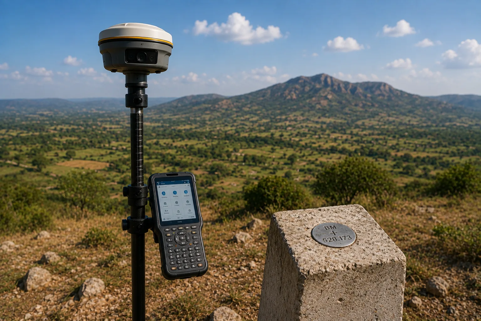
Now put a second receiver on a point whose coordinates you already know precisely — a control point, established earlier and recorded.
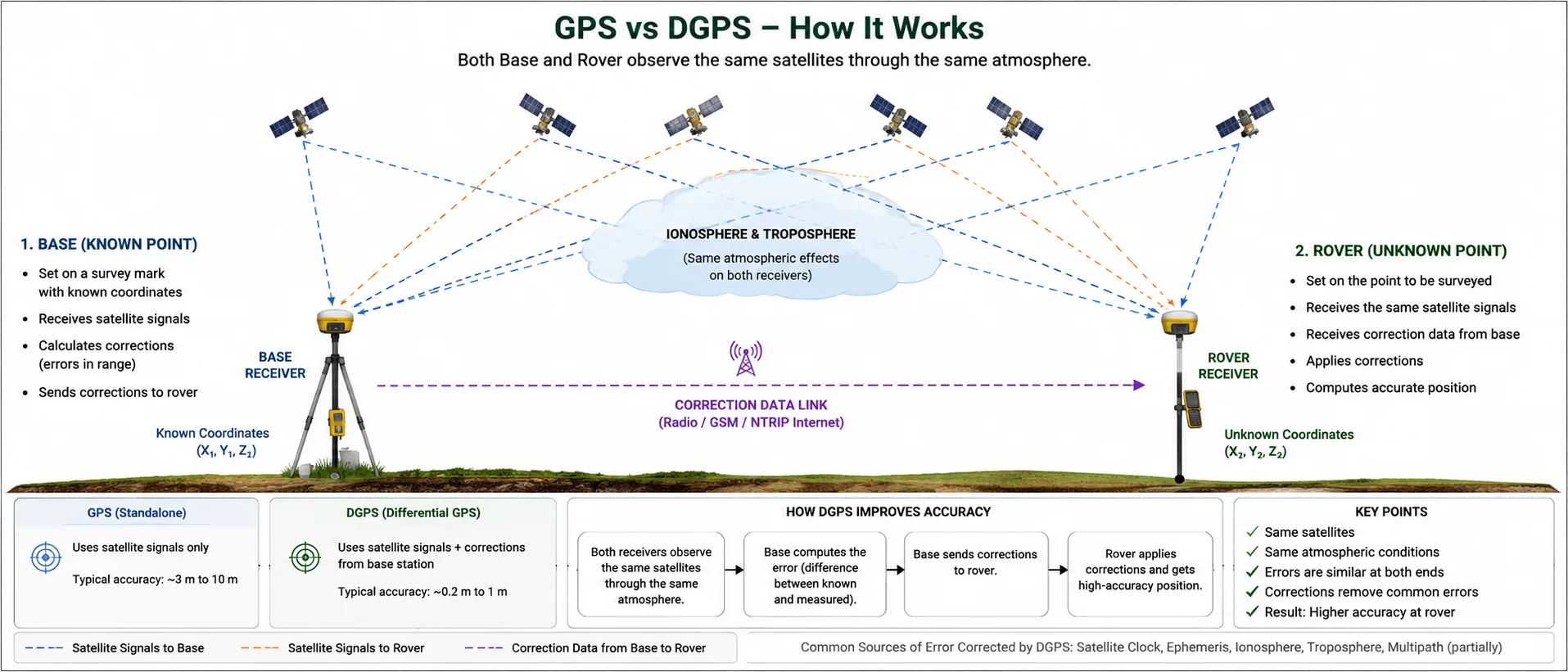
That receiver computes its position from the satellites like any other, and gets an answer that is wrong by some amount. But because it knows where it truly is, it can measure exactly how wrong: it subtracts its known position from its computed one and the remainder is the error, isolated and quantified, for each satellite, at that instant.
Here is the part that makes it work. A receiver a few kilometres away is looking at the same satellites through very nearly the same patch of atmosphere. It is suffering almost exactly the same errors. So the corrections measured at the known point apply, near enough, to the unknown one. Subtract them and the bias largely cancels.
That is all "differential" means: measure the error where you can, remove it where you cannot. The known receiver is the base; the moving one is the rover. Metres become millimetres.
Why distance to the base matters
The cancellation is only as good as the assumption that both receivers see the same atmosphere. Move the rover far enough away and that stops being true — different patch of sky, different ionospheric delay, and the correction fits less well.
This is what the ppm in an accuracy specification means. When a receiver is quoted at ±8 mm + 1 ppm, the 8 mm is its fixed measurement uncertainty and the 1 ppm — one part per million — is error that grows with the baseline. One part per million is 1 mm per kilometre. So at 10 km from the base, add 10 mm to the fixed figure.
Practical consequence: on a normal site the ppm term is negligible, and on a long corridor project it is not. That is one reason corridor work uses multiple bases rather than one at the depot.

Real time or afterwards — RTK and static
The corrections have to reach the rover somehow, and there is a choice about when.
RTK — real time kinematic. The base transmits corrections continuously by radio or over the mobile network, and the rover applies them as it goes. Stand on a point, wait a few seconds, get coordinates on the screen. This is what makes satellite survey fast: you can walk a site picking up points, and you know immediately whether the fix is good.
Static. The receiver sits on one point for a much longer occupation, recording raw observations rather than solving anything. Later, in the office, those observations are processed against the base's recordings of the same period. Nothing is real time and nothing is rushed.
Static is more accurate, for two reasons: a long occupation sees the satellite constellation move across the sky, which strengthens the geometry; and processing afterwards can iterate, reject bad observations and use precise orbit data that was not available live.
| RTK | Static | |
|---|---|---|
| Time on point | Seconds | Long occupation |
| Answer available | In the field, immediately | After office processing |
| Accuracy | Millimetres to low centimetres | Best available from satellites |
| Right for | Detail, setting out, checking | Control points and benchmarks |
In practice both get used on the same job, and in a specific order: static establishes the framework, RTK fills in the site. Control points observed in static mode are what let next year's setting out sit on the same coordinates as this year's survey. Skipping that step is why drawings from different visits so often refuse to overlay.
GPS is only one constellation
"GPS" is an American system, and the habit of using the word for all satellite positioning is now well out of date. A modern survey receiver also tracks Russia's GLONASS, China's BeiDou, Europe's Galileo and Japan's QZSS.
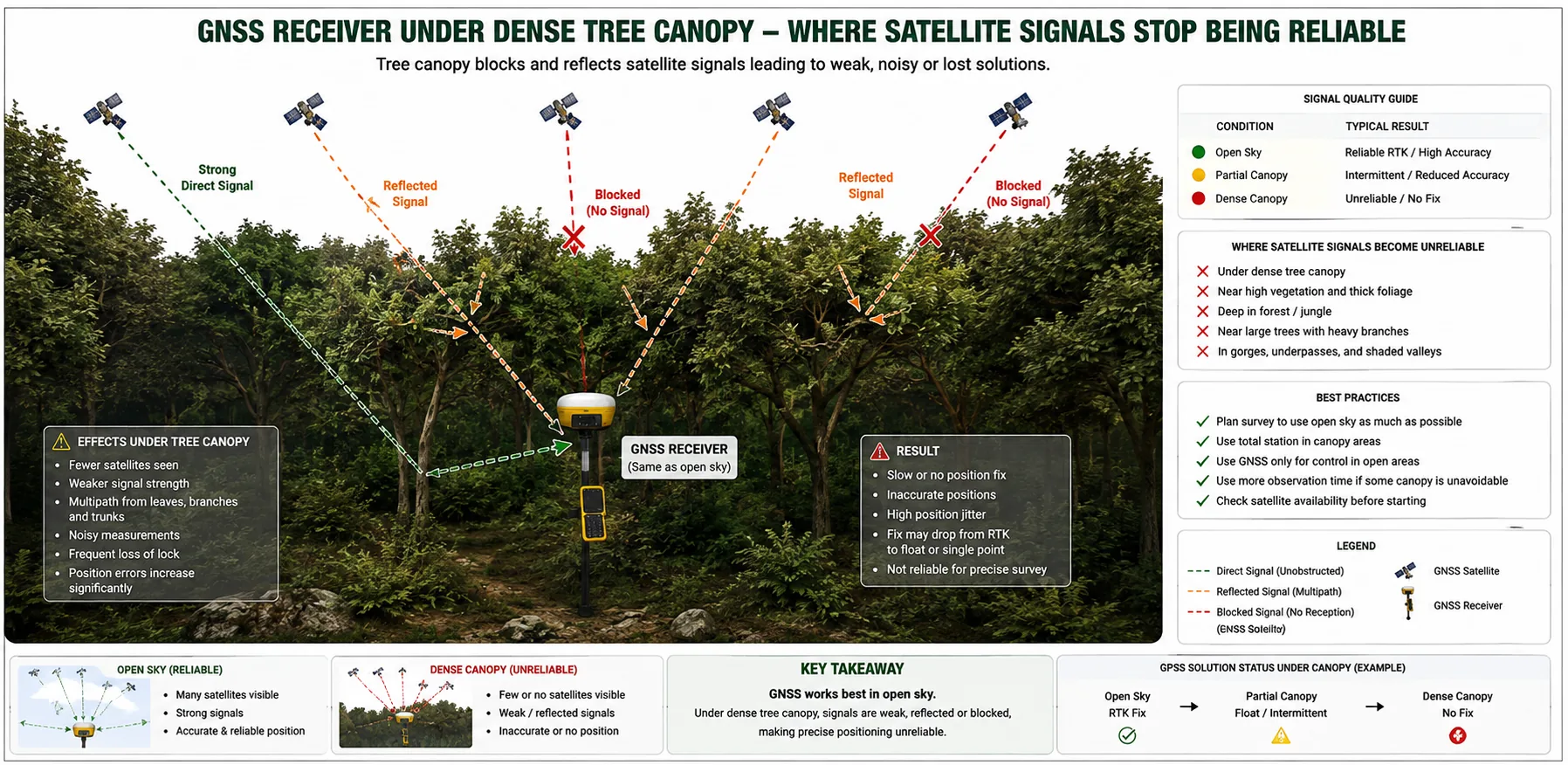
More constellations means more satellites in view at any moment. That matters most exactly where positioning is hardest — a site with buildings or trees blocking part of the sky may have too few GPS satellites visible to solve a position at all, but enough across four systems to carry on working.
Where it stops working
All of this depends on receiving a clean signal from the sky, and that is a real constraint rather than a minor caveat.
- Dense canopy absorbs the signal. Under plantation or heavy tree cover a receiver may never fix.
- Tall buildings block part of the sky, and worse, reflect signals. A reflected signal took a longer path, so the receiver computes a position from a distance that is wrong — multipath, and it is insidious because the result can look perfectly confident.
- Narrow lanes, courtyards and compounds combine both problems.
- Indoors, basements, under bridges — no signal at all.
On those parts of a site the answer is a different instrument entirely. A total station needs no sky, only line of sight between itself and its target. Which method suits which site is covered in total station or DGPS.
One more warning about height
Satellite positioning is weaker vertically than horizontally — expect roughly twice the error — because satellites are spread above the receiver but never below it, so the vertical is solved from a poorer geometry.
More importantly, the height a satellite receiver reports is not a level above mean sea level. It is height above a mathematical model of the earth, and in India the two differ by tens of metres. Anyone designing drainage from a raw satellite height is going to have a bad time. That one deserves its own article: why satellite levels are not sea levels.