
Construction Survey
Layout survey — your building marked exactly where the drawing puts it
We transfer the approved drawing onto the ground: footprint, reference lines and offset marks, placed before the first trench is dug. Get this right and everything built afterwards is in the right place.
On site this work is usually called layout marking or building marking. It is the same job.

What you get
Agreed in the quotation before we mobilise. A layout survey normally delivers:
- Building corners and reference lines marked physically on the ground
- Offset pegs set clear of the excavation, so marks survive the digging
- Permanent control points at the site edge, for every later stage of the build
- A temporary benchmark on site, with its level clearly stated
- Setting-out drawing showing every mark, its coordinates and its offsets
- Coordinate schedule in CSV or Excel, so any lost mark can be reinstated exactly
- Written note of anything on site that does not agree with the drawing

Setting out is not the same as measuring
Every other survey we do answers the question where is this? Setting out answers the opposite one: put this exactly here.
That difference matters because there is no second chance to notice a mistake. A measured drawing that is slightly wrong gets corrected on the next revision. A building set out slightly wrong gets concrete poured on top of it.
So the work is checked differently. Positions are set out, then independently re-observed from different control before anyone is told they can dig. Key dimensions are measured back against the drawing rather than assumed correct because the calculation looked right.
What we need before we start
- Approved drawings — architectural and structural, dimensioned, and the current revision
- The plot boundary — located, because setbacks are measured from it
- A level reference — your benchmark, or we establish one
- A cleared site — the footprint area accessible and free of debris
- Someone with authority on site — to confirm the position before it is marked
If the boundary has not been identified, that comes first — see boundary identification. Setting a building out from an assumed boundary is how setback problems begin.
If the drawing does not fit the plot, we stop and tell you
It happens more often than people expect. A setback that cannot be achieved on the measured plot. A footprint a little wider than the land actually is. A boundary that is not where the drawing assumed it was. Two drawings that disagree with each other.
We will not quietly shave a dimension to make it fit. The problem is reported before any mark goes in, so your architect can decide what to do about it.
Discovering this at setting-out stage costs a phone call. Discovering it after the foundation is poured costs a great deal more.
Tolerance, and keeping the marks alive
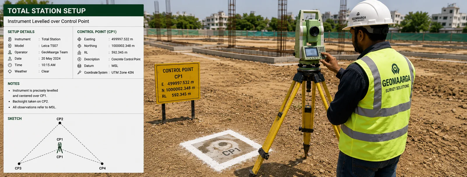
Building corners and reference lines are set out to within a few millimetres of their designed position, working from a closed and adjusted control network.
But precision on day one is only half the job. Marks inside a footprint do not survive an excavator, and pegs get moved, buried or used as shuttering props. So the layout is built to be recoverable:
- Offset pegs set outside the construction zone, on the same lines
- Permanent control at the site edge, away from traffic and stacking
- Every mark recorded as a coordinate, so reinstating one is a short visit, not a fresh survey
- Reference marks described and photographed, so your site engineer can find them without us
Protect the offset pegs and the control points and the layout will survive the whole build. Lose them and every later stage starts again.
Accuracy you can expect
| Method | Accuracy | Used for |
|---|---|---|
| Total station on adjusted traverse | ±10–20 mm | Corners, reference lines, offsets — most setting out |
| Auto level, closed run | ±5–10 mm vertical | Benchmark transfer and formation levels |
| DGPS, RTK | ±8 mm + 1 ppm | Large open sites and initial control |
Figures are typical achievable tolerances for survey-grade equipment under reasonable field conditions, not a contractual guarantee. Setting out is carried out with a 3″ class total station from control closed to 1:10,000 or better. The accuracy achieved on your project is stated in the report.
When you need this
- Before excavation begins on any building
- When a plot is tight and setbacks have to be exact
- When more than one block has to sit correctly relative to the others
- When the site slopes and the footprint has to be positioned in three dimensions
- When earlier marks have been lost and the layout must be re-established
- Before a statutory inspection that checks position against the sanctioned plan
Typical applications
- Individual house on a plotFootprint and setbacks marked against the sanctioned plan
- Apartment and commercial blocksFootprint, grid reference lines and control for the whole build
- Multi-block developmentsEvery block positioned correctly relative to the others and the site
- Industrial sheds and warehousesLarge footprints where accumulated error would show at the far corner
- Compound walls and gatesSet out on the identified boundary, not an assumed one
- Re-establishing a lost layoutOriginal positions recovered from the recorded coordinates
Related reading
Setting out is total station work — construction sites have walls, stacked material and part-built structure blocking the sky that satellite equipment needs, and the tolerance is tighter than satellite methods deliver reliably.
- Total station or DGPS — how we choose the method
- Why satellite levels are not sea levels
- GPS vs DGPS — the differential principle
Related services
- Grid Setting Out — the structural grid the frame is built to
- Foundation Marking — footings and excavation extents
- Column Marking — column centres floor by floor
- Level Transfer — carrying the datum up the building
- As-Built Survey — what was actually constructed
- Boundary Identification — needed before setting out
- All construction survey services
How we work
How we set a building out
-
Check the drawings against the plot
Dimensions, setbacks and the footprint compared against the measured boundary before anyone mobilises. Problems are raised now, not on site.
-
Establish control
Permanent reference points set at the site edge, clear of traffic, and closed onto each other so every position later comes from a checked framework.
-
Transfer the level
A benchmark brought onto site by closed level run and marked permanently, so floor levels through the whole build come from one agreed value.
-
Set out and mark
Corners and reference lines positioned from the control, marked on the ground, with offset pegs placed clear of the excavation.
-
Check independently
Every marked position re-observed from different control, and key dimensions measured back against the drawing, before anyone is told to dig.
-
Hand over the record
Setting-out drawing, coordinate schedule and photographs issued, and your site engineer walked through where the marks are and how to protect them.
Questions
Layout survey FAQs
The approved architectural and structural drawings with dimensions, the plot boundary, and a level to work from. If the boundary has not been located we will need to do that first, because setbacks are measured from it. If the drawings are still changing, wait — setting out from a superseded revision is the most expensive mistake on this list.
Building corners and reference lines are set out to within a few millimetres of their designed position, working from control that has been closed and checked. What matters as much is that the marks stay usable: they are placed clear of the excavation, referenced back to offset pegs, and recorded as coordinates so any mark lost to site traffic can be reinstated exactly rather than approximately.
We stop and tell you before anything is marked. It happens more often than people expect — a setback that cannot be achieved, a footprint wider than the measured plot, a boundary that is not where the drawing assumed. Finding it at setting-out stage costs a phone call. Finding it after the foundation is poured costs a great deal more.
Expect it — excavators and material stacking will destroy marks inside the footprint. That is why the working marks are backed by offset pegs set outside the construction zone, and by permanent control points at the site edge. Every mark is recorded as a coordinate, so reinstating a lost peg is a short visit rather than a fresh survey. Protect the offset pegs and the control, and the layout survives the job.
Yes, and it is common — later floors, additional blocks, or a layout that has to be re-established after the original marks were lost. Provided the original control still exists, or enough built structure can be measured to recover it, we can pick the work back up. Tell us what has already been built so the visit is planned around it.
If you ask us to. A check survey after excavation or after the first pour compares what is built against what was set out, and reports the difference. It is inexpensive relative to the cost of discovering a problem at slab level, and many clients treat it as a standard second visit rather than an extra. See as-built survey.
Yes. Layout marking, building marking and layout survey all describe the same work — transferring the approved drawing onto the ground so the building is built in the right place. Site teams and engineers use different names for it. Ask for whichever term you are used to; we will know what you mean.