
Choosing a method
Total station or DGPS — how to choose the right method for your site
The question is almost never which instrument is better. It is what is above your site — because one method needs a clear view of the sky and the other needs a clear line of sight.
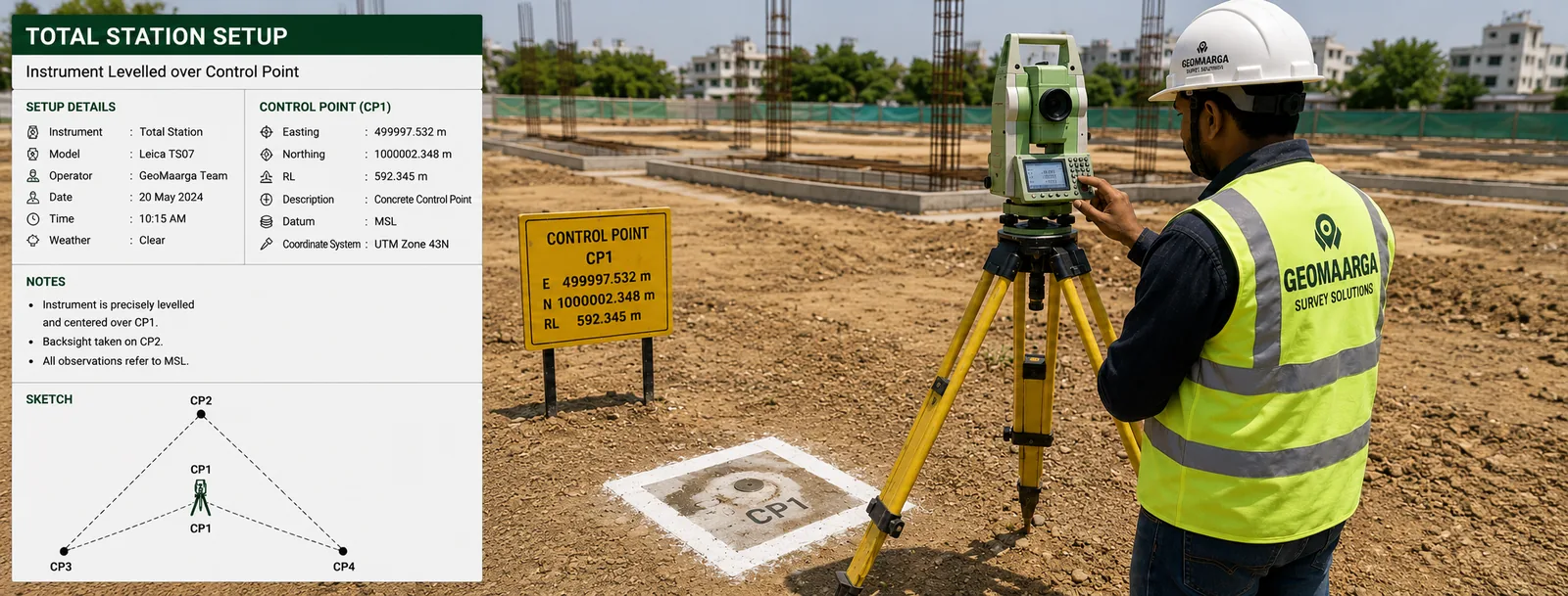
Two instruments, two different requirements
A total station measures an angle and a distance from where it stands to a target you point it at. It needs to see that target. It does not care what is overhead — canopy, a bridge deck, a roof, five storeys of adjacent building are all irrelevant.
A DGPS or GNSS receiver works out where it is from satellites. It needs a clear view of the sky and does not care whether anything on the ground is in the way — no line of sight to anything is required, and it can work alone with nobody holding a target.
So the two fail in completely different circumstances, and that is what makes the choice straightforward once you look at the site rather than the price list.
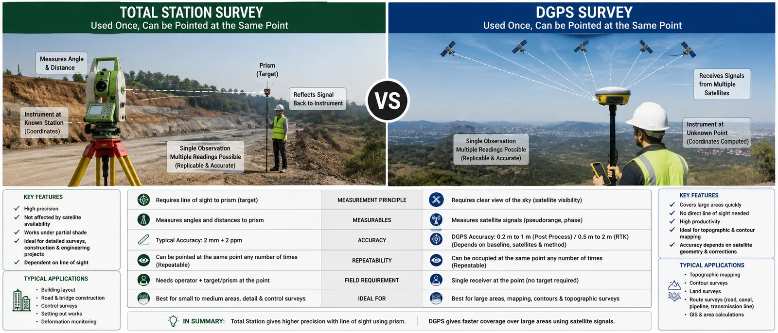
Side by side
| Total station | DGPS / GNSS | |
|---|---|---|
| Fundamental need | Line of sight to target | Clear view of the sky |
| Under tree canopy | Works | Unreliable or fails |
| Between tall buildings | Works | Blocked or reflected |
| Indoors, basements, under bridges | Works | Does not work |
| Large open ground | Slow, many setups | Much faster |
| Long distances | Error accumulates along traverse | No accumulation |
| Vertical accuracy | Better | Roughly half as good as its horizontal |
| Crew | Usually two | Can be one |
| Weather sensitivity | Heat shimmer, heavy rain | Ionospheric conditions |
Why it is usually not either-or
Read that table again and notice something: the two lists of weaknesses barely overlap. Where one struggles the other is comfortable. That is not a coincidence — it is why a working survey team carries both.
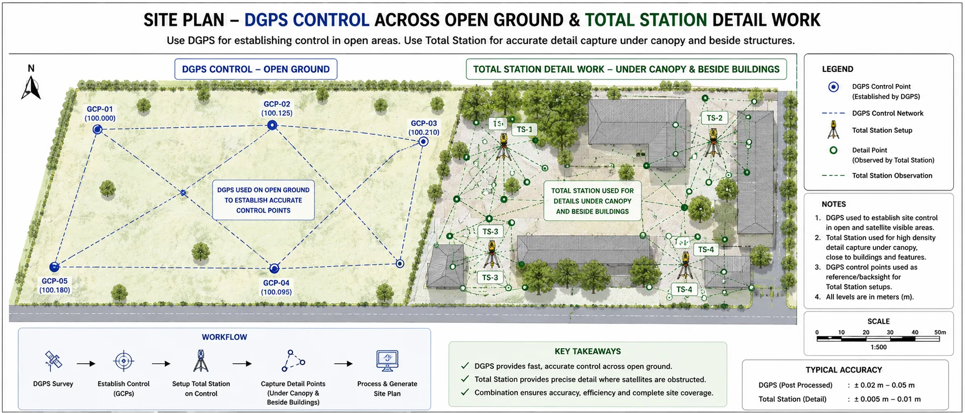
The normal pattern on a real site is a division of labour:
- DGPS establishes control across the open parts of the site, quickly, without accumulating error over distance.
- The total station works from that control to pick up detail in the obstructed parts — under the trees, along the compound wall, between the existing blocks.
Each method is doing the thing it is good at, and the total station's one real weakness — that error builds up as you traverse away from your starting point — is solved by having satellite-established control points scattered across the site to tie into.
If a surveyor tells you a mixed site needs only one method, ask why.

A quick way to decide
Stand on the site and look up. Then work down this list.
- Open sky nearly everywhere, site larger than a few acres — DGPS leads, total station for the few obstructed corners.
- Urban plot with buildings close on two or more sides — total station leads. Satellite work will suffer multipath even where it appears to fix.
- Plantation, orchard or wooded ground — total station, almost entirely.
- Long corridor — road, canal, transmission line — DGPS for control along the route, total station for structures and detail.
- Tight vertical tolerance anywhere — levels by total station or auto level, whatever else is used for position.
- Indoors, basement, under a deck — total station only.
Multipath does not look like an error
When a satellite signal bounces off a building before reaching the receiver, it took a longer path — so the computed distance is wrong. The receiver has no way to know this happened. It reports a position with a confident-looking fix and a healthy satellite count, and the answer is out by centimetres or worse.
This is why "we got a fix" is not the same as "the point is right", and why control should be checked by re-observing it independently rather than trusted because the screen looked happy. On a site ringed by buildings, a total station is not being cautious — it is being correct.
What choosing wrong actually costs
Using a total station where DGPS would have done means paying for more field time than necessary. Annoying, but the drawing is right.
Using DGPS where a total station was needed is the expensive mistake, because the result can be wrong without looking wrong. Points under canopy that never quite fixed, positions beside a building corrupted by multipath, levels taken from satellites when the drainage design needed millimetres — these surface later, during construction, when something does not fit.
The asymmetry is worth remembering when comparing two quotations where one is noticeably cheaper.